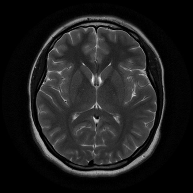
The objective of this project is to evaluate the performance of different machine learning classification algorithms paired with image processing techniques. Additionally, we will use the trained models to predict the level of dementia based on the MRI images. This project was developed for a Machine Learning class at the University of São Paulo (USP) in 2021. Because of this, most of the reports are in Portuguese. I will try to translate them to English as soon as possible. For now use the markdown file on this github repository as a guide to the project.
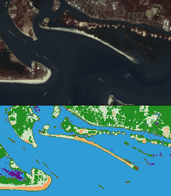
The main objective is to classify the landscape of an satellite image to provide information for environmental studies. The datasets used are from the satellite Sentinel-2 and Google Earth. The input images are rasters formed by eight bands that will be processed with the intention of providing indexes and other usefull statistics. The landscape and forest classification is determined by a machine learning method called Naive Bayes. Access the source code by following this link.
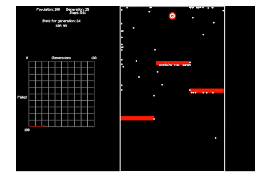
This project was developed for a Evolutionary Systems Applied to Robotics class at the University of São Paulo (USP). The objective was to develop a genetic algorithm that could reach a goal avoiding obstacles. Check the source code by following this link.